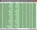
Geodata Germany 29.02
- Buy $175
- Developer Link 1 (geodatde.zip)
- Download3k US (geodatde.zip)
- Download3k EU (geodatde.zip)
MD5: 6e9f4a678429f87af702c87262d49323
All files are original. Download3K does not repack or modify downloads in any way. Check MD5 for confirmation.
Quick Review
"Geodata of the Federal Republic of Germany."
Geodata Germany is a comprehensive software solution that provides an extensive collection of geospatial data for the Federal Republic of Germany. The software encompasses a vast array of information, including georeferenced towns, municipalities, town quarters, and other administrative units. It also includes data on postal codes, telephone preselections, nature areas, landscapes, climatic zones, and official topographical cartographies.
One of the key features of Geodata Germany is its ability to offer precise coordinates for navigation, geocoding, proximity searches, and distance computations. This feature enables users to map and analyze environmental information effectively. When working with addresses, such as town or municipality names, postal codes, or telephone preselections, the software facilitates a geo reference, connecting the address field to the corresponding geographical data and coordinates.
The geo reference functionality opens up numerous possibilities for practical applications. For instance, it can be utilized to guide customers to the nearest store locations of a retail store chain by conducting proximity searches. Additionally, it allows users to determine distances between different objects within the database tables using the provided geo references.
Geodata Germany also incorporates elevation data obtained from a Digital Elevation Model, enabling the determination of ground level heights for each location. This information is particularly valuable for various purposes, such as calculating static loads for building constructions and planning solar installations.
Understanding the affiliations and relationships between data derived from different hierarchies is crucial in many scenarios. Geodata Germany facilitates this by providing information on the federal state, governmental area, or governmental county associated with a specific town, postal code, or telephone preselection.
The software includes a diverse range of natural and scenic information that can be assigned to each town or municipality. Moreover, local climatic data such as snow and wind load zones, as well as solar irradiation, are readily available. These data points, combined with the ground level heights, enable precise calculations for static loads in building construction and solar installations.
Geodata Germany boasts an extensive database with approximately 11,500 towns and municipalities, 108,000 town quarters, 31,000 postal codes, and 19,500 telephone preselections, all equipped with their respective geo references. Additionally, it provides information on 400 administrative counties, administrative districts, and federal states of Germany. The software also includes data on landscapes, nature area classification, snow and wind load zones, solardata, and cartographies.
Geodata Germany is designed to be compatible with all systems and is exclusively focused on providing high-quality data. With its wide range of features and comprehensive database, this software is an invaluable tool for professionals and researchers who require accurate and detailed geospatial information for Germany.
Requirements: All systems, only data
What's new in this version: All database tables updated to the data status of January 1, 2025. New data fields "Sunshine Duration" and "Precipitation Amount" added. Solar irradiances in w/m2 and in kWh/m2a added. Snow load zones ">3" and ">3a" supplemented. DHDN/degree coordinates and Google Plus codes added.
Antivirus information
-
Avast:
Clean -
Avira:
Clean -
Kaspersky:
Clean -
McAfee:
Clean -
NOD32:
Clean
Popular downloads in Business & Finance
-
 Website Builder 9.0
This web site builder gives you everything y -
 PDF to Word | Solid Converter 10.1
Convert PDF to Word -
 Real Estate Price Calculator 3.0.1.5
Lands area length converter price calculator -
 Face Recognition System 2.0
Matlab source code for Face Recognition. -
 WPS Office Free 12.2.0.18911
Perfect free for creating & editing documents -
 XLS (Excel) to DBF Converter 3.16
Allows you to convert XLS files to DBF format -
 vCard Wizard 4.25
Transfer any Contacts. vCard vcf converter -
 Bill Maker 1.0
Bill, Invice, Inventory management -
 OEE 2
OEE 2
OEE calculator for MS Excel -
 Foxit Reader 10.0.0.35798
Protects Against Security.The Best PDF Reader


