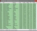
Geodata Germany 29.02
Developed by Killet GeoSoftware Ing.-GbR
-
Windows
-
setup file geodatde.zip (3.65 MB)
-
Data Only
Buy or select mirror:
- Buy $175
- Developer Link 1 (geodatde.zip)
- Download3k US (geodatde.zip)
- Download3k EU (geodatde.zip)
MD5: 6e9f4a678429f87af702c87262d49323
All files are original. Download3K does not repack or modify downloads in any way. Check MD5 for confirmation.
Developer Description
"Geodata of the Federal Republic of Germany."
The database tables contains geodata of the Federal Republic of Germany with geo referenced towns, municipalities, town quarters and other administrative units, postal codes, telephone preselections, nature areas, landscapes, climatic zones and official topographical cartographies. The data contain coordinates for navigation and geo-coding, proximity searches and distance computations and are prepered for the spatial mapping of environmental information. Quite often it is necessary to reference an address field e.g. like town or municipality name, postal code or telephone preselection, to corresponding geographical data and coordinates - a Geo Reference. The geo reference can be used e.g. to direct a customer to the closest store locations of a retail store chain by doing a proximity search. Another possibility it to determine distances between the different objects of the database tables with the included geo references. With the elevation data from a Digital Elevation Model the ground level height of each place can be determined. Often the knowledge is necessary about affiliations and relationships between data derived from different hierarchies. So it can be determined to which federal state, governmental area or governmental county a town, a postal code or a telephone preselection is associated. It is possible to assign a variety of natural and scenic information to each town or municipality. The snow and wind load zones and solar irradiation are available as local climatic data. In conjunction with the ground level heights they can be used to calculate static loads for the planning of building constuctions and to calculate solar installations. Databases: 11.500 Towns and Municipalities, 108.000 Town Quarters, 31.000 Postal Codes, 19.500 Telephone Preselections, all with geo references, 400 Administrative Countys, Administrative Districts, Federal States of Germany, Landscapes, Nature Area Classification, Snow and Wind Load Zones, Solardata, Cartographies.Requirements: All systems, only data
What's new in this version: All database tables updated to the data status of January 1, 2025. New data fields "Sunshine Duration" and "Precipitation Amount" added. Solar irradiances in w/m2 and in kWh/m2a added. Snow load zones ">3" and ">3a" supplemented. DHDN/degree coordinates and Google Plus codes added.
Antivirus information
Download3K has downloaded and tested Geodata Germany on 9 Feb 2025 with some of Today's best antivirus engines and you can find below, for your convenience, the scan results:
-
Avast:
Clean -
Avira:
Clean -
Kaspersky:
Clean -
McAfee:
Clean -
NOD32:
Clean
Popular downloads in Business & Finance
-
 Website Builder 9.0
This web site builder gives you everything y -
 PDF to Word | Solid Converter 10.1
Convert PDF to Word -
 Real Estate Price Calculator 3.0.1.5
Lands area length converter price calculator -
 Face Recognition System 2.0
Matlab source code for Face Recognition. -
 WPS Office Free 12.2.0.18911
Perfect free for creating & editing documents -
 XLS (Excel) to DBF Converter 3.16
Allows you to convert XLS files to DBF format -
 vCard Wizard 4.25
Transfer any Contacts. vCard vcf converter -
 Bill Maker 1.0
Bill, Invice, Inventory management -
 OEE 2
OEE 2
OEE calculator for MS Excel -
 Foxit Reader 10.0.0.35798
Protects Against Security.The Best PDF Reader


